October 19, 2026
Turia Gardens Valencia: Route, Bridges and History
Active life, Culture, Family-friendly
Top attractions:
The Turia Gardens (Jardín del Turia) are Valencia’s main street, except that nobody drives on them. For more than 9 km / 5.6 mi, according to Visit València, a green corridor of palms, orange trees, pines, sports pitches and playgrounds follows the old bed of the River Turia from Cabecera Park (Parque de Cabecera) in the west to the City of Arts and Sciences (Ciudad de las Artes y las Ciencias) in the east. Valencians cross the city on it by bike, run it at dawn, picnic on it at weekends and watch fireworks from it during Fallas. That it exists at all is the result of a flood, an engineering decision and a citizens’ campaign.
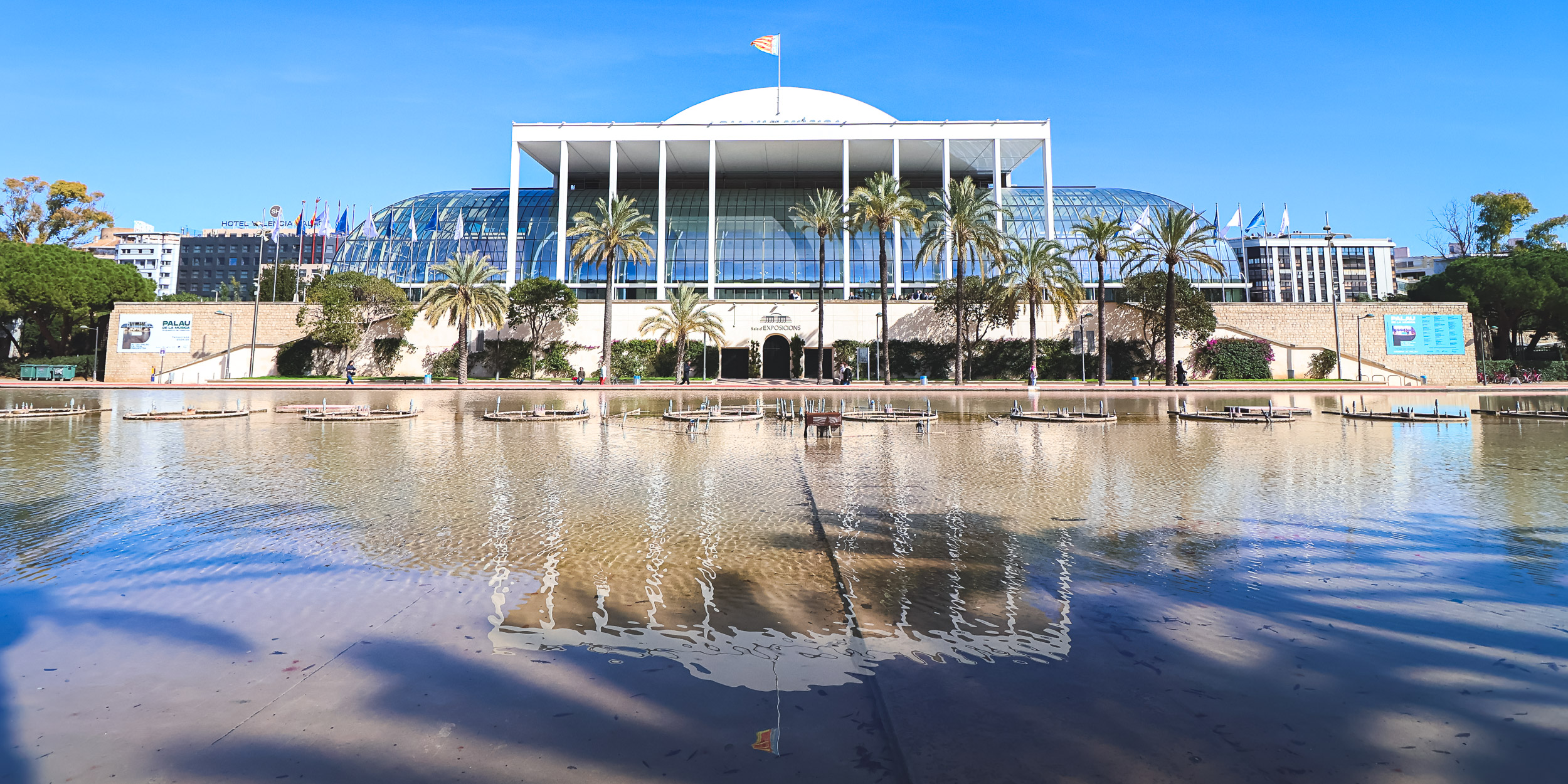
The Palau de la Música (Palacio de la Música) and its pool, in the stretch designed by Ricardo Bofill. Photo by Alis Monte [CC BY-SA 4.0], via Connecting Valencia
From River to Garden: A Short History
The Turia flooded Valencia for centuries; the five historic stone bridges were rebuilt in stone between 1356 and 1607, most of them after floods (the 1517 flood swept away the Serranos, Real and San José bridges; the 1589 flood took the old Sea Bridge). The worst came on 14 October 1957. In response, the Plan Sur, approved by law in December 1961, diverted the river into a new channel south of the city, leaving the old bed dry. The authorities then planned to run motorways along it.
Valencians objected. Under the slogan “El llit del Túria és nostre i el volem verd” (“the Turia bed is ours and we want it green”), neighbourhood associations, professional bodies and civic groups campaigned through the transition to democracy. King Juan Carlos I signed the transfer of the riverbed to the city in December 1976. In 1981 the first democratic mayor, Ricard Pérez Casado, commissioned the architect Ricardo Bofill, whose plan of January 1982 proposed a single classical garden along the whole bed. It proved controversial and was built only in part: Bofill’s stretch beside the Palau de la Música (Palacio de la Música) opened in June 1987, and the rest was laid out section by section by other designers in the following years, which explains why the gardens change character every few bridges. The city approved a full restoration of the Bofill stretch in May 2026, keeping his original design.
The Route, West to East
The gardens are divided into numbered sections between the bridges. Walked or cycled from the west, the main stops come in this order.
Cabecera Park and the Bioparc
The western end is Cabecera Park, a landscaped park with a lake and swan-shaped pedal boats. Beside it is the Bioparc, a zoo built around recreated African habitats rather than cages.
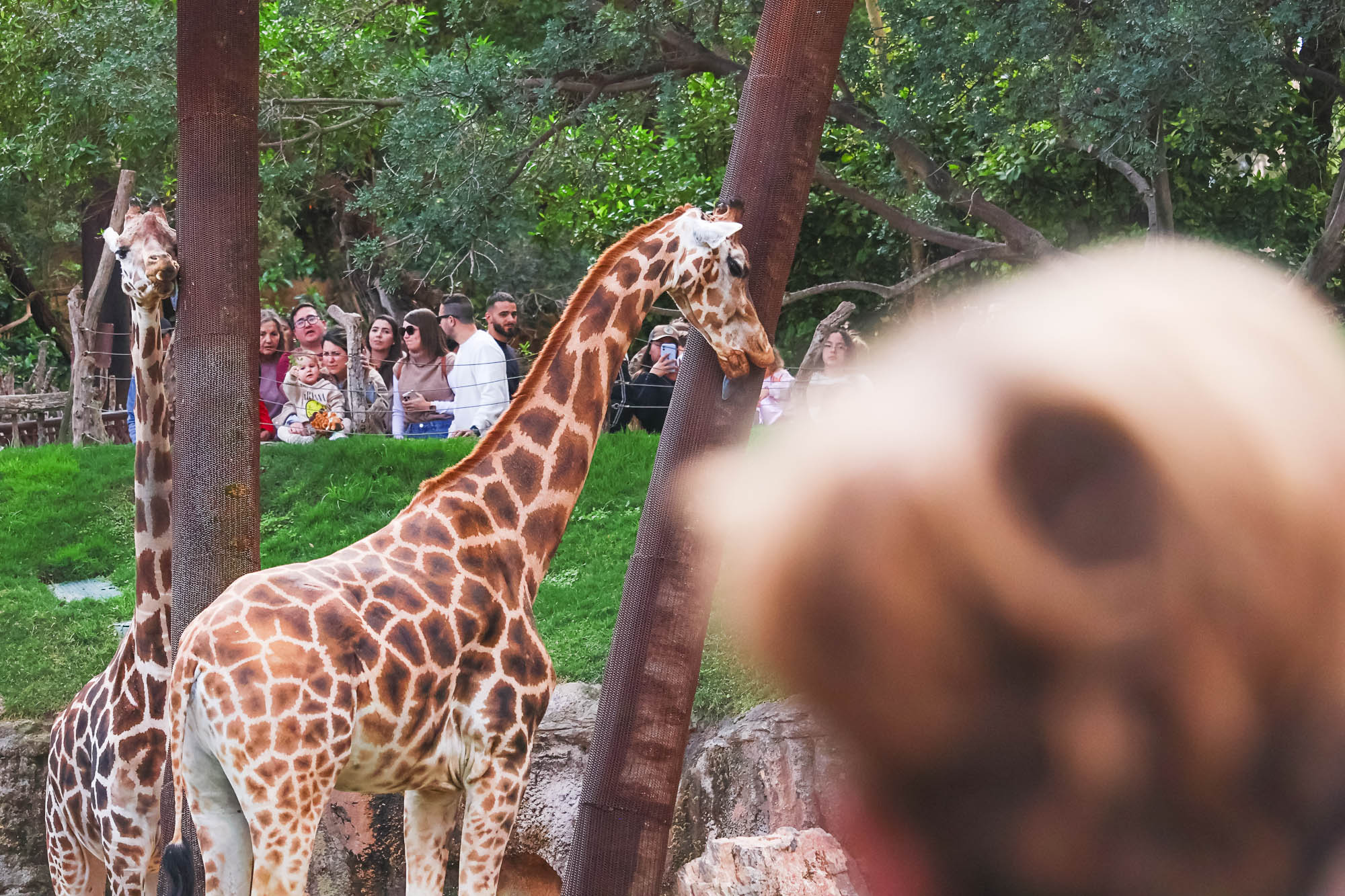
Giraffes in the Bioparc (Bioparc Valencia), at the western end of the gardens. Photo by Alis Monte [CC BY-SA 4.0], via Connecting Valencia
The old town stretch: Serranos and the historic bridges
East of Campanar the gardens run along the edge of the old town. The Serranos Towers (Torres de Serranos), the medieval city’s northern gate, rise on the south bank, and their terraces give the best view down into the riverbed. Across the gardens stands the Museum of Fine Arts (Museo de Bellas Artes), whose collection includes a room for Joaquín Sorolla, with the Royal Gardens (Jardines del Real), known locally as Viveros, behind it.
The Palau de la Música and the Bofill gardens
Downstream, sections X and XI are the only part built to Bofill’s plan: a symmetrical garden of clipped trees and a long pool in front of the glass façade of the Palau de la Música, the concert hall that opened on 25 April 1987 facing the riverbed.
Gulliver Park
Further east, Gulliver Park (Parque Gulliver) is a giant figure lying on its back that children climb, slide down and explore like Lilliputians. The city commissioned it in 1990 from the architect Rafael Rivera, the illustrator Sento Llobell and the fallas artist Manolo Martín. The figure is 70 m / 230 ft long.
The City of Arts and Sciences
The eastern end belongs to the City of Arts and Sciences, built in the riverbed itself. Santiago Calatrava designed the Hemisfèric (Hemisférico), the Science Museum (Museo de las Ciencias Príncipe Felipe), the Umbracle (Umbráculo) and the Queen Sofía Palace of the Arts (Palacio de las Artes Reina Sofía); at the far end, the Oceanogràfic (Oceanográfico) has roofs by Félix Candela.
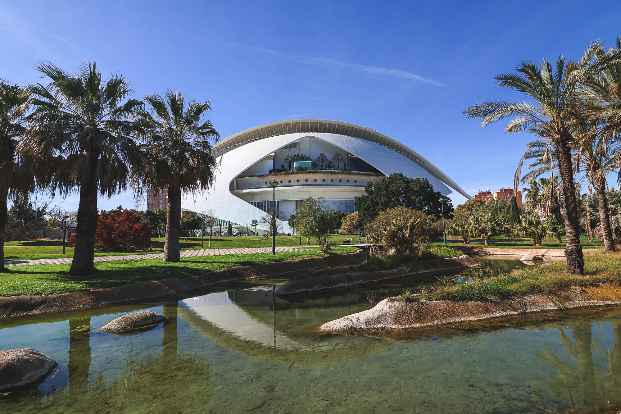
The Queen Sofía Palace of the Arts (Palacio de las Artes Reina Sofía), where the gardens meet the City of Arts and Sciences (Ciudad de las Artes y las Ciencias). Photo by Alis Monte [CC BY-SA 4.0], via Connecting Valencia
The Bridges
Eighteen bridges cross the gardens, from Gothic stone to white steel. They are a history of the city in themselves.
- Trinity Bridge (Puente de la Trinidad): built in stone between 1356 and 1402, the oldest surviving bridge. It replaced a Muslim-era crossing and survived the floods of 1406, 1427 and 1517 almost unharmed. It is about 158 m / 518 ft long on ten pointed arches.
- Serranos Bridge (Puente de Serranos): rebuilt in stone in 1518 after the 1517 flood, leading straight to the Serranos gate.
- Sea Bridge (Puente del Mar): 1592–1596, on the old road to the port, replacing the bridge lost in the 1589 flood.
- Royal Bridge (Puente del Real): 1594–1599, replacing the bridge lost in the 1517 flood; it linked the city with the royal palace in today’s Royal Gardens.
- St Joseph’s Bridge (Puente de San José): 1604–1607, replacing the bridge lost in the 1517 flood, and the last of the historic stone bridges.
- Exposition Bridge (Puente de la Exposición): Calatrava’s high-strength steel bridge, opened in 1995 together with the Alameda metro station beneath it, nicknamed “la Peineta” (the comb) for its arch, which is 14 m / 46 ft high and inclined at 70°. The bridge is almost 131 m / 430 ft long and stands beside the site of the old Exposition footbridge (pasarela de la Exposición).
- Assut de l’Or Bridge (Puente del Azud del Oro): Calatrava’s cable-stayed bridge beside the City of Arts and Sciences.
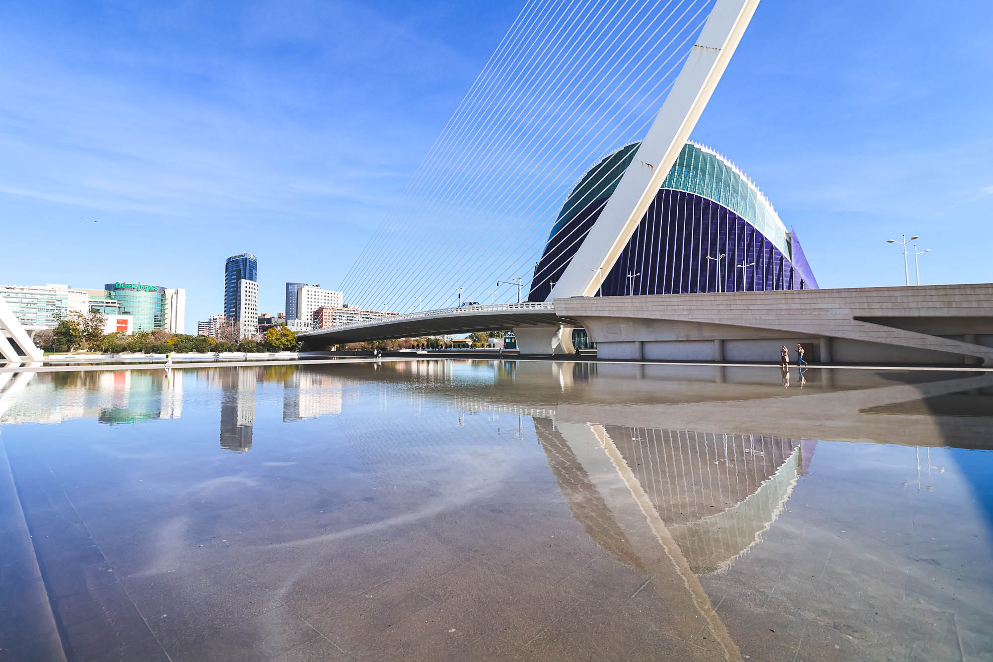
The Assut de l’Or Bridge (Puente del Azud del Oro), Calatrava’s cable-stayed crossing at the eastern end. Photo by Alis Monte [CC BY-SA 4.0], via Connecting Valencia
How to Visit
The gardens are free and open, and the paths are flat, so the whole length is an easy bike ride or a long walk. Cycling is the classic way to see them: Visit València recommends it as the fastest way across the city, away from traffic. Metro lines 3, 5 and 7 and many buses stop near the gardens; for the old town stretch, get off near the Serranos Towers. Shade is generous under the trees, but the eastern end around the City of Arts and Sciences is open and hot in summer, so start early or late.
Respect the gardens as Valencians use them: as a park, a running track and a commuting route at once. Keep to the bike lanes when cycling, slow down near playgrounds, and take litter with you.
Guided bike tours combine the old town, the gardens and the City of Arts and Sciences. Look among the Valencia tours on GetYourGuide for the City Highlights Guided Bike Tour or the Turia Park Guided Bike Tour.
When to Go
Mornings and late afternoons are best for light and temperature. In July the Gran Feria de Valencia puts much of its programme in the gardens, and during Fallas the night-time fireworks, including the Nit del Foc, are fired over the riverbed. For the city’s history from the Romans to the 1957 flood, read our history of Valencia; for everything else, see our things to do in Valencia guide.
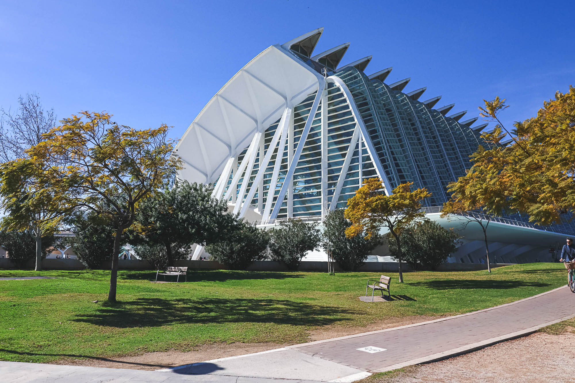
The Science Museum (Museo de las Ciencias Príncipe Felipe) from the riverbed. Photo by Alis Monte [CC BY-SA 4.0], via Connecting Valencia
Frequently Asked Questions
How long are the Turia Gardens?
More than 9 km / 5.6 mi, from Cabecera Park (Parque de Cabecera) and the Bioparc in the west to the City of Arts and Sciences (Ciudad de las Artes y las Ciencias) in the east.
Why is there a park in the old river?
After the flood of 14 October 1957 the Plan Sur (1961) diverted the Turia south of the city. A citizens' campaign stopped plans for motorways, and the riverbed was handed to the city in 1976 and turned into gardens from the 1980s.
Are the Turia Gardens free?
Yes. They are a public park, open and free, with flat paths for walking, running and cycling.
What is the oldest bridge over the Turia?
The Trinity Bridge (Puente de la Trinidad), built in stone between 1356 and 1402.
Can you cycle through the Turia Gardens?
Yes. Cycling the gardens is the classic way to cross the city away from traffic; keep to the bike lanes.