May 21, 2024
Best Hikes in Cap de Sant Antoni from Denia & Javea
Active life, Guide, Hiking, Natural park
Top attractions:
Quick Navigation
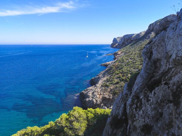
Hiking in Cap de Sant Antoni
Most of the hiking routes listed in this article are just sections of the PR-CV 355 hiking trail between Port Javea and El Montgo Peak. You might as well just do it, but for those less fitted, or not being able to spare a day for such a trail, there are more accessible options. Actually, everything except getting the names right is easy Cap de Sant Antoni.
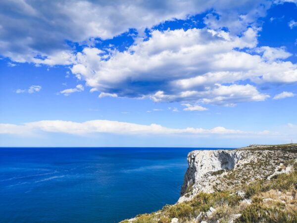
This natural marvel is named after the same saint as a famous city in Texas San Antonio, which is the Spanish name. The most common name – Cap Sant Antoni – is in the local Valenciano language, but it is also known in English as Saint Anthony’s Cape or Cape San Antonio, and in Spanish: Cabo San Antonio). In case you get confused it is all the same thing. The good part, as I said, everything else is simple, especially, getting good vistas with little to no effort. Though some cliffs of the Cape rise about 150 m / 500 ft above the sea level, the Cape is very flat. Walking here is a breeze, especially if you start hiking from one of the parking spaces on top of Cap de Sant Antoni.
Cap de Sant Antoni Details
- Location: Spain
- Region: Valencia
- Main hub: Javea & Denia
- Distance from Alicante: 90km / 55.92mi
- Distance from Valencia: 105km / 65.24mi
- Distance from Benidorm: 55km / 34.18mi
- Area: 1.1 km² / 0.42 mi²
- Lat/Lon: 38°47’30″N 0°11’41”E
- Highest point: Cap de Sant Antoni (170 m / 557 ft)
- Weather: Cap Sant Antoni forecast
- Emergency number: 062 and 112
- Guided Tours & Transfer: Cova Tallada boat tour, Cova Tallada kayak trip & Cap de Sant Antonio kayak trip
Map with Hiking Routes in Cap de Sant Antoni
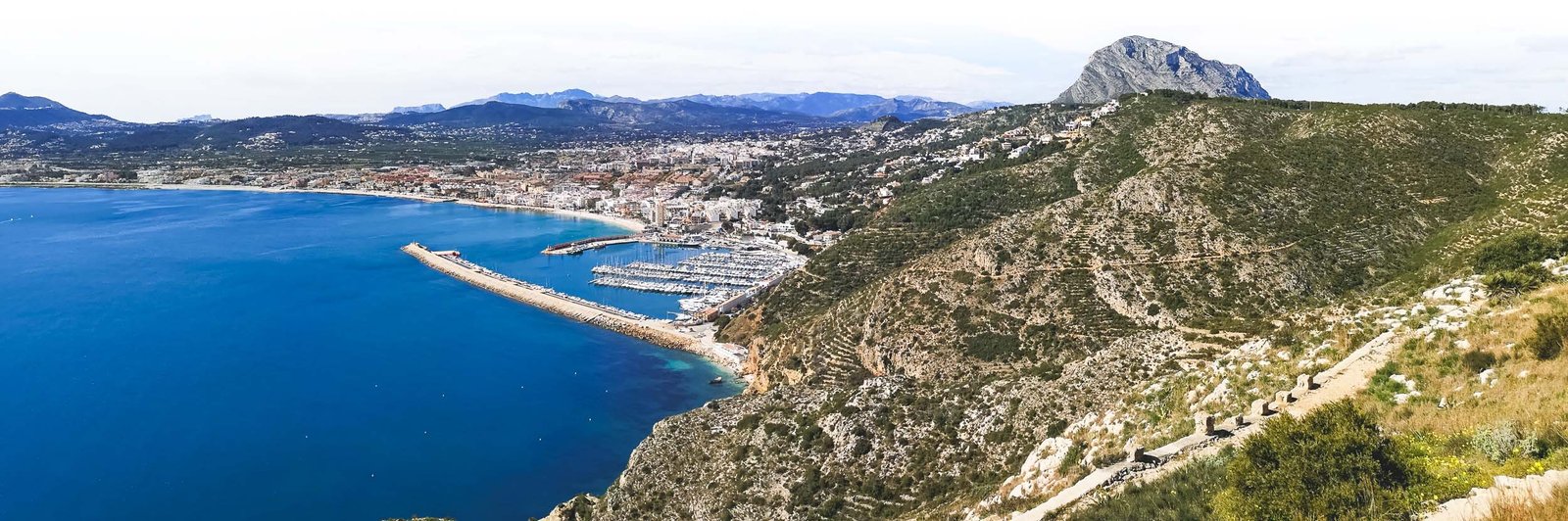
Javea Bay from Cap de Sant Antoni – the view one can hardly get enough of. Photo by Alis Monte [CC BY-SA 4.0], via Connecting the Dots

Molins Circular Hike
Situated on the plateau of Cap de San Antoni, this circular hike suits almost everyone. Given the easy access via Denia-Javea CV-736, it offers almost free exceptional vistas that would otherwise require a steep climb. Molins Circular Hike offers amazing views towards both sides of the cape, with its crown jewel being the mesmerizing view towards Javea from the windmill area.
Pro tip: Make a small detour on Denia’s side to a beautiful viewpoint: Mirador del Cuni.
Hike Details
- Distance: 5.5km / 3.4mi
- Duration: 1h30-2h00
- Difficulty: Easy
- Color: Yellow
- Type: Circular
- Route: Aparcamiento Merendero – Mirador del Cuni – Els Molins – Santuario de Nuestra Señora de los Ángeles
- Coordinates: 38º80’54 ″ N – 0º17’69 ″ ° W

Javea area from Cap Sant Antoni. Photo by Alis Monte [CC BY-SA 4.0], via Connecting the Dots
Aparcamiento Merendero – Cap de Sant Antoni
Not really a hiking trail but rather just a section of it, but arguably the best part of it. Especially if you add a little twist to it and walk off the main road to an unnamed viewpoint, which offers the best views of the tip of Cap de Sant Antoni itself I’ve managed to find so far. The quality of the road is not as good as Molins Circular Hike which could be done from the same parking, but it is flat, thus suitable for most of people. If you don’t have much time to explore, this might be the route to make a good impression of what Cap de Sant Antoni has to offer in general.
Hike Details
- Distance: 1.9 km / 1.18 mi x2
- Duration: 0h30 x2
- Difficulty: Easy
- Color: Yellow
- Type: Linear
- Starting location: Aparcamiento Merendero
- Target location: Cap de Sant Antoni
- Coordinates: 38º81’75 ″ N – 0º16’74 ″ ° W
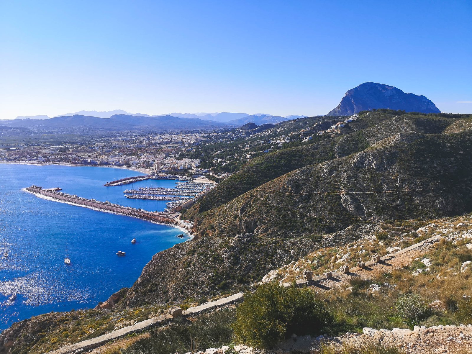
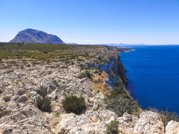
The view towards Port Javea from Cap Sant Antoni. Photo by Alis Monte [CC BY-SA 4.0], via Connecting the Dots
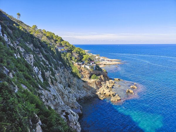
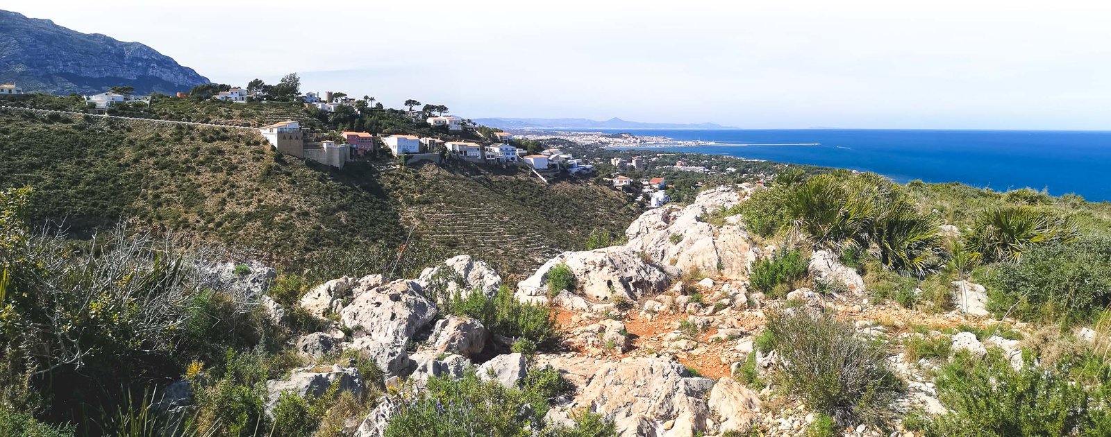
Port Javea – Cap de Sant Antoni
The signature hike of Javea from the port part of the town climbs Cap de Sant Antoni which is, after all, much closer to Javea than it is to Denia. Many locals and visitors of the town climb the cape each day, and so do the large houses of the super-rich living, or, at least, owning properties in otherwise protected areas. Javea missed the opportunity to preserve its side of the cape but luckily the hike goes through the remote untouched section of the last terrain of the Baetic mountains systems before it sinks into the deep sea and remerges again only in the Balearic Islands. Port Javea – Cap de Sant Antoni is a great nature getaway from an otherwise busy area.
Hike Details
- Distance: 1.9 km / 1.18 mi x2
- Ascend: 154 m / 505 ft
- Duration: 1h00 x2
- Difficulty: Easy
- Color: Red
- Type: Linear
- Starting Location: Javea port
- Target Location: Cap de Sant Antoni
- Coordinates: 38º80’16 ″ N – 0º19’08 ″ ° W
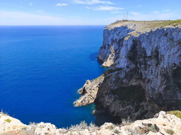
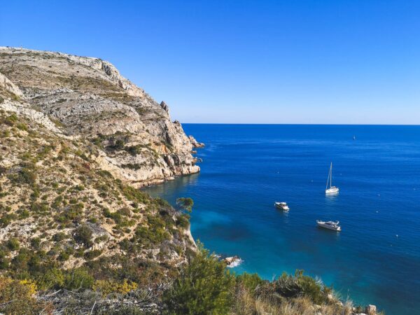
Cova Tallada hike is among the top activities in Denia, Photo by Alis Monte [CC BY-SA 4.0], via Connecting the Dots
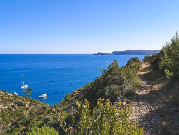
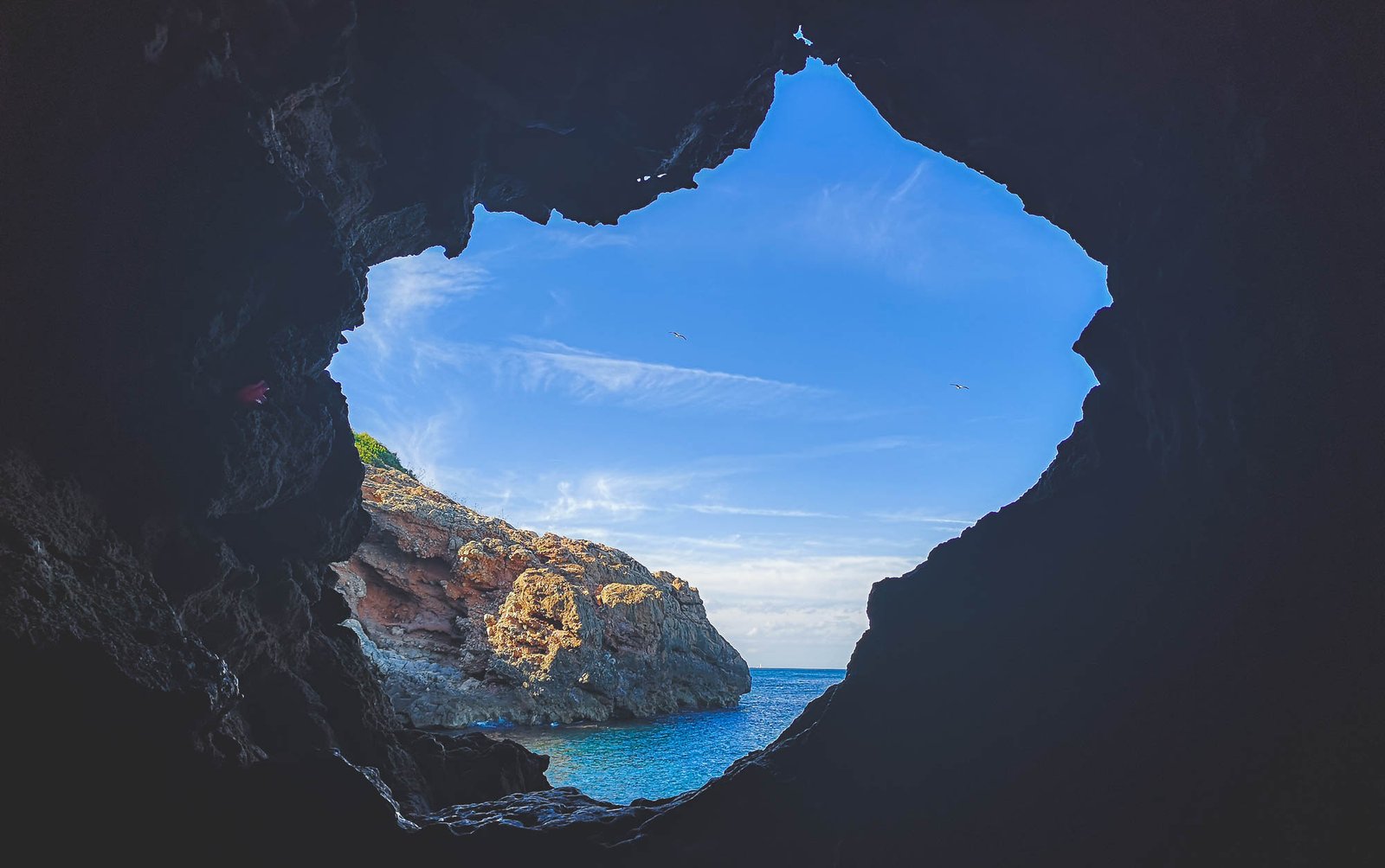
Cova Tallada Hike
Cova Tallada is a cave system by the Mediterranean Sea below high cliffs of Cap Sant Antoni. Might be the crown jewel of the whole area, I even did this hike on my Spain road trip when I had no idea what Denia or Marina Alta is. This rather short hikes is by no means for everyone – being able to tolerate heights and good shoes is the minimum requirement. Nevertheless, the hike to Cova Tallada is a very popular among tourists and locals alike. Due to some people not being able to keep even the simplest safety rules, the access to the hike is limited during peak seasons.
Pro tip: Cova Tallada is a great snorkeling spot
Hike Details
- Distance: 1km / 0.62mi
- Duration: 30-40min
- Difficulty: Easy/Moderate Depending on season and experience
- Color: Yellow
- Type: Linear
- Starting location: Les Rotes, Denia
- Target location: Cova Tallada
- Coordinates: 38º81’75 ″ N – 0º16’74 ″ ° W
- Permit: Required between June 15 – September 30
- More information: Hiking Cova Tallada
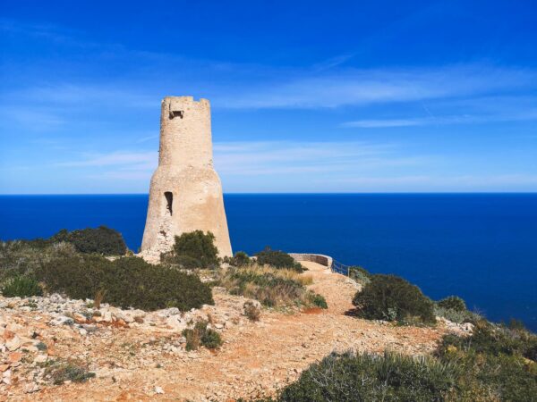
Torre del Gerro Hike
A small climb from the same location in Les Rotes as the Cova Tallada route starts. This is the shortest hike on the list, though be cautious – even given the wee distance and a relatively good road – it is a steep climb to Torre del Gerro. I wouldn’t suggest attempting the hike on a hot day unless you know what you’re doing. From Torre del Gerro beautiful vistas open towards Denia and its coast. Other hiking trails connect Torre del Gerro with Cova Tallada and Cap Sant Antoni.
Hike Details
- Distance: 1km / 0.62mi
- Ascend: ± 120m / 400 ft
- Duration: 20-30min x2
- Difficulty: Easy/Moderate Depending on season and time of date
- Color: Yellow
- Type: Linear
- Starting location: Les Rotes, Denia
- Target location: Torre del Gerro
- Coordinates: 38º81’89 ″ N – 0º15’73 ″ ° W
- More information: Hike on Komoot
- Download: Hike GPX
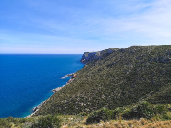
Torre del Gerro – Cap de Sant Antoni – Altomira
This hike leads from one area of Denia through Cap de Sant Antoni to another, to be more precise from coastal Les Rotes to the highest part of the Montgo neighborhood. Adding an extra 1 or 2 km it is possible to connect the hike into a full circle. The route includes beautiful vistas of Cap de Sant Antoni, Les Rotes, Denia, and El Montgo. This is not an official hike and runs through sections of Torre del Gerro – Molins, PR-CV 355, and Cami de Colonia in the el Montgo hiking area.
Hike Details
- Distance: 4.4km / 2.73mi
- Ascend: ± 130m / 425 ft
- Duration: 1h30min
- Difficulty: Moderate
- Color: Yellow
- Type: Linear
- Starting location: Torre del Gerro
- Target location: Altomira
- Coordinates: 38º80’89 ″ N – 0º12’77 ″ ° W
- More information: Hike on Komoot
- Download: Hike GPX
All content and photos by Alis Monte. If you want to collaborate, contact me on info@wp.connectingcosta.com Photo by Alis Monte [CC BY-SA 4.0], via Connecting the Dots