Top attractions:
About Moraira
Moraira is the seaside half of Teulada-Moraira, the municipality whose official name is still Teulada, on the Marina Alta coast between Calpe and Xàbia. It grew up as a fishing village under the protection of an 18th-century fort, shipped the district’s raisins to Europe and America in the 19th century, and since the late 1960s has been one of the resorts of the Costa Blanca. South of the harbour, the headland of Cap d’Or closes the bay, crowned by a 16th-century watchtower that once warned the inland villages of Barbary corsairs.
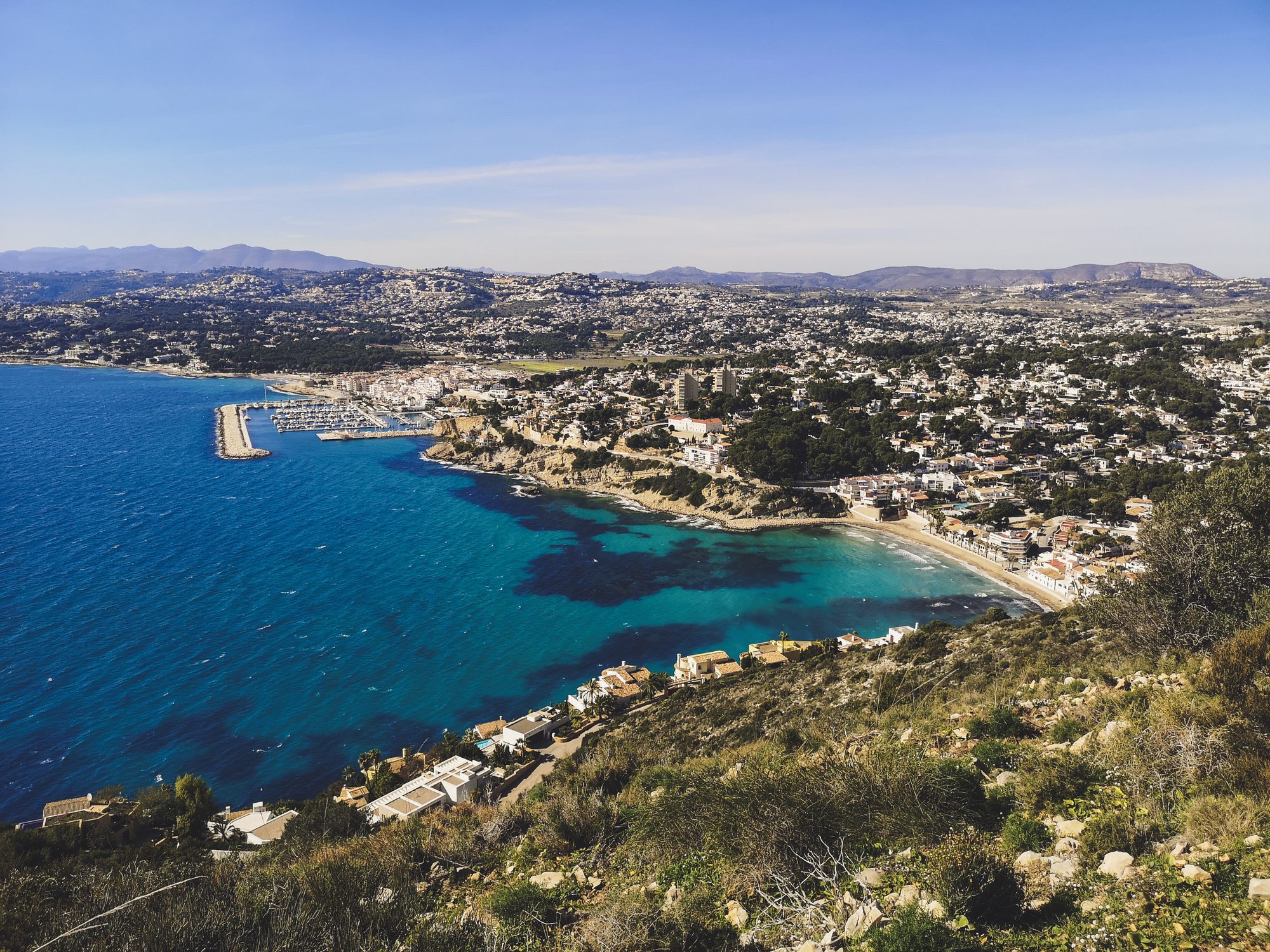
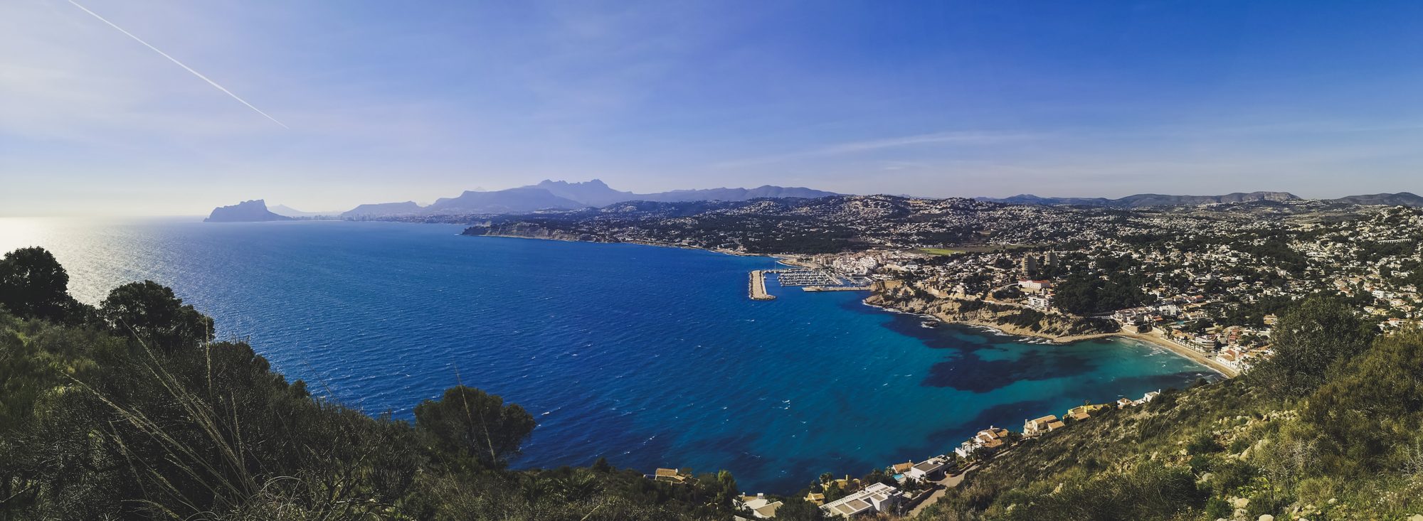
Moraira, its marina and the bay from the trail up Cap d’Or. Photo by Alis Monte [CC BY-SA 4.0], via Connecting Valencia
Moraira Details
- Location: Teulada-Moraira, Marina Alta, Alicante province
- Distance from Valencia: about 110 km / 68 mi south
- Cap d’Or trail: SL-CV 51, 1.70 km / 1.06 mi, +205 m / 673 ft, about 50 min, from the El Portet beach car park; returns the same way
- Blue Flag beaches: El Portet and Les Platgetes
- Market: Fridays 8:30–13:30, Les Sorts car park (Teulada: Wednesdays 8:30–13:30, Plaza VI Centenari)
- Moraira Castle: free entry; hours change with the season
- Tourist office: Avinguda de Madrid 15 (Espai La Senieta), Moraira; Teulada-Moraira Tourist Info (Spanish and English)
- Kayak tour: Kayak Route from Moraira
The Cap d’Or Walk
The short signposted trail SL-CV 51 climbs from El Portet beach to the Cap d’Or watchtower (Torre del Cap d’Or), known on the trail signs by its Valencian name, Torre de Guaita del Cap d’Or (guaita means watch). From the beach car park on Avinguda del Portet it threads uphill through the streets of the villa district to the start of the path, then makes a short, steep climb to a col. The official figures are 1.70 km / 1.06 mi with 205 m / 673 ft of ascent, about 50 minutes without stops, and the walk returns the same way. The path is rocky, has steps and is not step-free; the whole headland lies within the Penya-segats de la Marina protected area, with a plant micro-reserve on the cape.
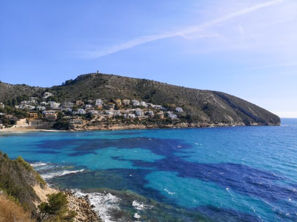
El Portet bay, with the watchtower hill of Cap d’Or above it. Photo by Alis Monte [CC BY-SA 4.0], via Connecting Valencia
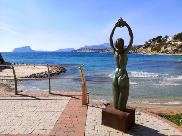
A bronze statue on the El Portet promenade, with the Peñón de Ifach on the horizon. Photo by Alis Monte [CC BY-SA 4.0], via Connecting Valencia
From the col, a detour down steps on the left leads to Cova de la Cendra, a sea cave in the cliff, before you return to the col and continue along the Cocons cliffs. The path then crosses the remains of an Iberian settlement, with its cistern, on the headland, and ends at the tower, 166 m / 545 ft above the sea at the highest point of the cape. Lecterns in Castellano, Valencian and English explain the settlement and the tower. The views run north over Moraira and south along the coast to the Peñón de Ifach, which you can climb on its own Peñón de Ifach hike; the best coastal hikes of the Marina Alta pairs Cap d’Or with other walks on this coast.
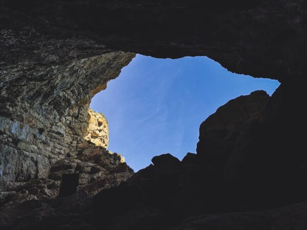
Cova de la Cendra, reached by steps from the col on the Cap d’Or trail. Photo by Alis Monte [CC BY-SA 4.0], via Connecting Valencia
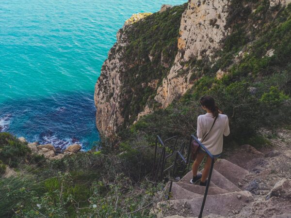
The trail down to Cova de la Cendra. Photo by Alis Monte [CC BY-SA 4.0], via Connecting Valencia
History
People have lived on this coast for millennia: the Iberian settlement on Cap d’Or was followed by Roman and then Andalusi farmers, who built the terraces that still shape the hills and left many of the place names. After Jaume I’s conquest in the 13th century, Teulada received its own municipal territory in 1386. From the 15th to the 17th century the coast lived under constant threat from Barbary corsairs, and the defences of that age survive in the watchtower, in Teulada’s fortress-church of Santa Catalina (Iglesia de Santa Catalina) and in its Sala de Jurats i Justícies, the old council hall.
The Cap d’Or watchtower belongs to the chain of towers built after the military engineer Giovanni Battista Antonelli surveyed this coast for Felipe II in 1563. It is a slightly tapering cylinder of rubble masonry about 11 m / 36 ft high, solid to half its height, with a vaulted chamber above and a flat roof terrace. Its lookouts signalled to the towers of the Granadella, Ambolo and Mascarat and to the Peñón de Ifach. In 1667 its guns covered a Neapolitan ship attacked by two pirate vessels; the ship sank in the Portet, Teulada’s authorities cared for the crew, and two of its cannon were recovered from the beach in 1980. The council restored the tower, the path and the access to Cova de la Cendra from 2020.
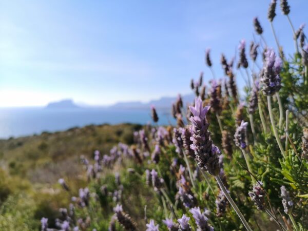
Lavender on Cap d’Or, with the Peñón de Ifach behind. Photo by Alis Monte [CC BY-SA 4.0], via Connecting Valencia
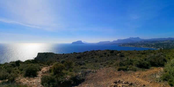
Looking south from Cap d’Or along the coast to the Peñón de Ifach and Benidorm. Photo by Alis Monte [CC BY-SA 4.0], via Connecting Valencia
Moraira Castle (Castillo de Moraira; Castell de Moraira in Valencian) was built in the 1740s above l’Ampolla beach. Its plan, with a semicircular south front and 10 m / 33 ft sloping walls of tosca, a stone cut from the local fossil dunes has seven gun embrasures, and a Bourbon shield sits over the door. It now houses a free interpretation centre on the coastal defence system. The fishing village grew up in the fort’s shadow, and in the 19th century the raisin trade brought it prosperity: Calle Almacenes is named after the warehouses where raisins were loaded onto fishing boats and rowed out to ships anchored in the bay. The first tourists came to El Portet and Les Platgetes in the mid-20th century.
Things to Do in Moraira
Beyond the Cap d’Or walk, the town’s pleasures are its water and its table. El Portet (Playa del Portet), a small shell-shaped bay of fine sand sheltered by Cap d’Or, and Les Platgetes, two small coves with a promenade and viewpoint, both hold the Blue Flag. L’Ampolla (Playa de l’Ampolla), below the castle, is the longest and busiest beach and is listed as an accessible beach. The rocky coves of Portitxol and l’Andragó have deep, clear water for snorkelling, and a coastal walk links six viewpoints from El Portet to Calle Túnez. On the water, the kayak route from Moraira leaves from the Club Náutico Moraira along the cliffs and sea caves.
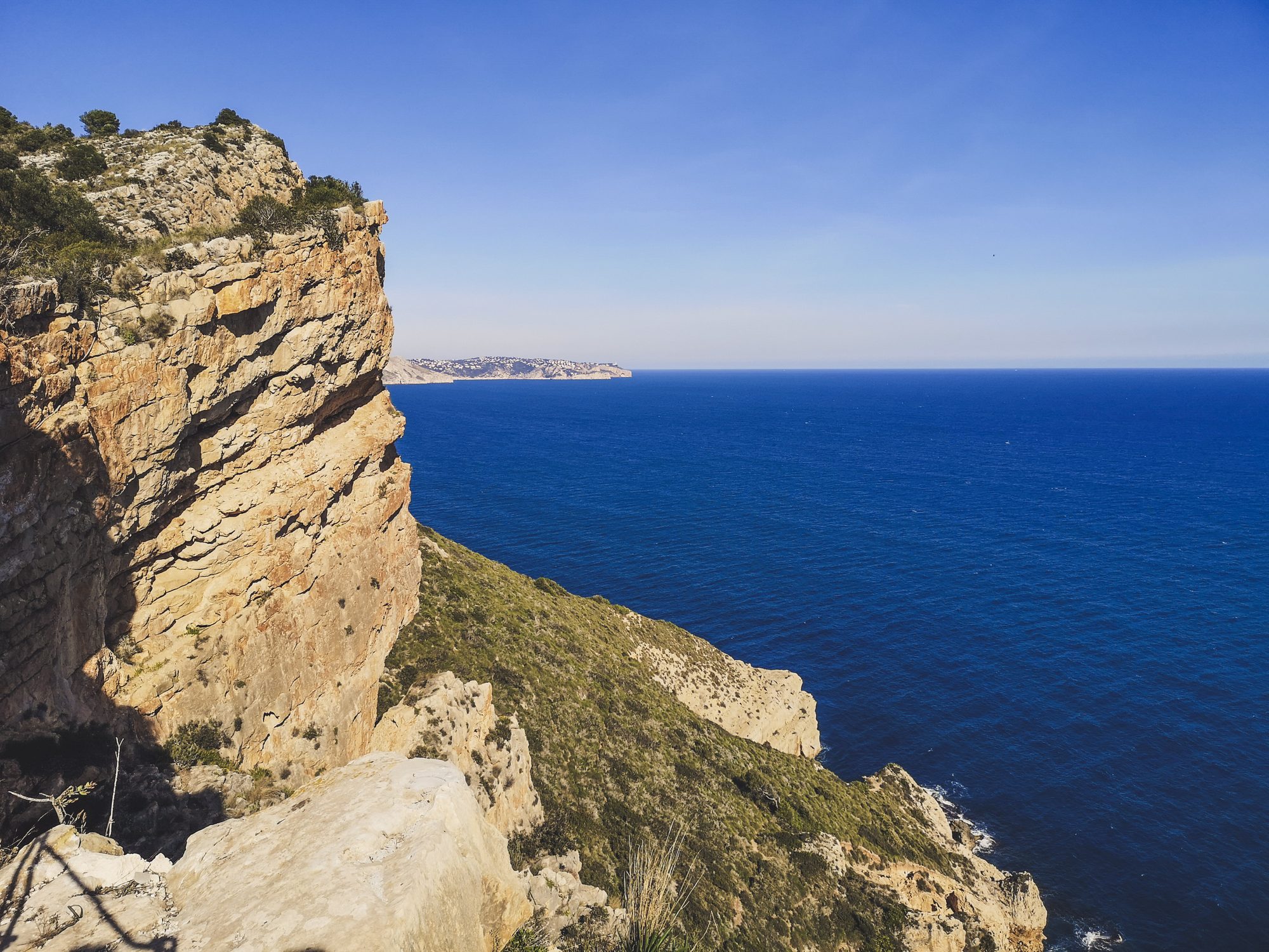
The golden cliffs of Cap d’Or above deep blue water. Photo by Alis Monte [CC BY-SA 4.0], via Connecting Valencia
The weekly market fills the Les Sorts car park every Friday from 8:30 to 13:30; Teulada, inland, holds its own on Wednesday mornings. Teulada-Moraira is Moscatel country: the local Moscatel Romano grape, grown on sunny slopes near the sea, goes into mistela (a fortified must), sweet Moscatel wines and the table grapes for which Teulada was once known in the markets of Madrid and Barcelona. The arcaded riuraus where the grapes were dried into raisins still stand in the countryside, and the inland routes of the Marina Alta lead through them. In the kitchen, rice is king (arròs a banda, arròs negre, arròs del senyoret), alongside putxero de polp, an octopus stew, and fish landed under the Bahía de Moraira quality mark.
Moraira’s calendar follows the sea and the vine. In June, Moros y Cristianos stages the Moorish landing and the Christian reconquest on l’Ampolla beach below the castle. Around 15 and 16 July the town honours its patron, the Mare de Déu dels Desemparats, and the Virgen del Carmen, patron of fishermen, with a maritime procession, fireworks over the water and the Bous a la Mar in the port. In late August the Festa del Moscatell celebrates the grape harvest with tastings of grapes and mistela, traditional dances and a short-film festival.
Getting to Moraira from Valencia
By car, take the AP-7 south to exit 63 (Teulada) or follow the N-332, then the CV-740 from Teulada down to the coast; Moraira is about 110 km / 68 mi from Valencia. By bus, ALSA’s Valencia–Alicante line stops at Teulada, where Autobuses Ifach runs on to Moraira on its Calpe–Teulada–Moraira line; check ALSA and Autobuses Ifach (Spanish) for timetables. No train runs to Moraira: the nearest rail is Teulada station on TRAM d’Alacant Line 9 (Benidorm–Dénia), inland, with a bus or taxi for the last stretch. Moraira also combines well with Calpe, on the same Ifach bus line.
All photos by Alis Monte. If you want to collaborate, contact me on hi@connectingvalencia.com. Photo by Alis Monte [CC BY-SA 4.0], via Connecting Valencia